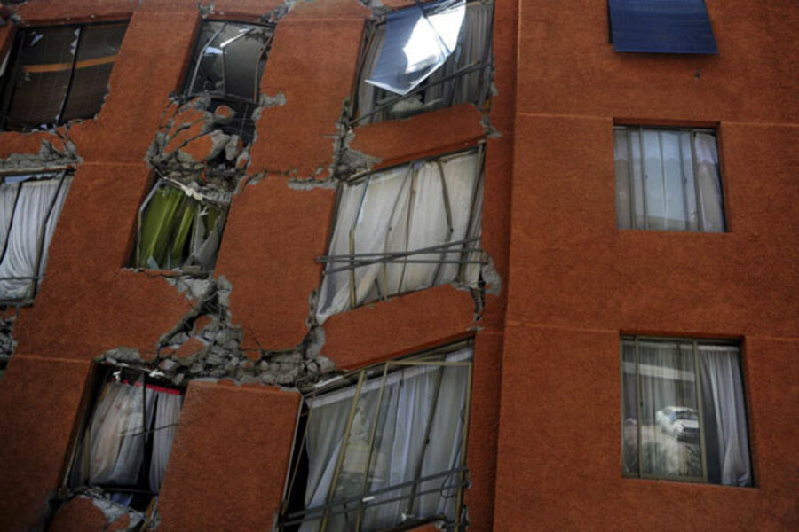
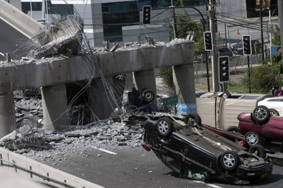
Chile earthquake, Hawaii tsunami: Why this happens
Loading...
The great earthquake that struck off the Chilean coast early Saturday serves as a stark reminder that the most violent earthquakes Earth’s restless crust can deliver happen along geological features that also appear along the Aleutian Islands, off the Pacific Northwest, and in the Caribbean.
“We have the threat of this kind of earthquake and tsunami in our back yards,” says Brian Atwater, a geophysicist at the University of Washington in Seattle.
The magnitude 8.8 quake that hit Chile some 70 miles northeast of the coastal city of Concepcion resulted from action along what earth scientists call a subduction zone. A vast plate of oceanic crust known as the Nazca plate is sliding at a relatively speedy clip beneath the more buoyant continental crust of South America.
IN PICTURES: Images from the 8.8 magnitude earthquake in Chile
Quakes are like a growth spurt
The squeeze one plate puts on the other as it slides back into the Earth’s mantle is building the Andes. When an event such as today’s quake occurs, it’s like a growth spurt, pushing the overlying crust up by several feet. That sudden displacement of mass underwater triggered the tsunamis that spread into the Pacific basin.
Today’s rupture occurred along a 248-mile length of a zone that traces the outline of most of South America’s west coast. The amount of slip was on the order of 30 feet, says Ray Russo, a University of Florida geophysicist whose research focuses on the region. He estimated that the crust closest to the epicenter may have experience uplift of three feet or more.
A more firm number will emerge after he and colleagues see GPS and radar-satellite data, he says.
Large earthquakes along the Nazca subduction zone – indeed along all of the earth’s subduction zones – are common. Globally, quakes with magnitudes comparable to today’s temblor occur on average once a year.
Since the 1970s, some 15 quakes in the magnitude 7 and 8 range have occurred along the Nazca’s subduction zone. The global-record holder occurred in 1960, when a magnitude 9.5 quake struck off the coast south of Conception.
Hard to predict when another quake will occur
Yet getting a better handle on the recurrence rate along any single section of the zone is tough, researchers say.
The most immediate predecessor to today’s quake appears to be a temblor that occurred in 1730, Dr. Atwater says. It’s documented in Spanish colonial records.
IN PICTURES: Images from the 8.8 magnitude earthquake in Chile
And a tsunami associated with the quake reached Japan and caused some damage.
But not long after, native Americans in that part of the continent drove the Spaniards out of the region, he says. So there’s precious little information on what might have happened during the intervening years.
“It’s an open question, how big an earthquake you can get on that part of the fault,” he says.
Subduction zones spawn the most powerful earthquakes
What is clear is that subduction zones in general are the spawning grounds for the most powerful earthquakes the planet can generate, researchers say. The reason has to do with the surface area involved in the rupture. The greater the surface area involved for a given amount of slip, the more powerful the quake.
Some plate boundaries appear largely as vertical faults that slide past each other, such as California’s San Andreas or Haiti’s Enriquillo-Plantain Garden Fault. Along these sorts of faults, hardscrabble rock extends straight down into the crust only so far before it’s heated and becomes a taffy-like fluid.
Crust sliding down through a subduction zone, by contrast, does so at a relatively shallow angle. The result: for a given length along which a rupture occurs, the surface area involved is larger for a subduction zone quake than for one involving a strike-slip fault.
Nasty surprises
For all that scientists are learning about these key features of the planet’s ever-migrating crust, subduction zones still yield nasty surprises – ones with a direct bearing on evaluations of the seismic and tsunami hazards people in a subduction region may face.
For instance, it’s become increasingly clear that earthquakes along strike-slip faults can trigger quakes along other segments of the same fault – or on faults far distant.
Research suggests that a magnitude 7.9 quake near Mt. Denali in Alaska in 2002 appears to have triggered an uptick in small earthquakes in California, Russo says.
But quakes along subduction zones? Up to 2004, he explains, most geophysicists held that once a segment of a subduction zone snapped, the show was over – at least for a couple of centuries while stress in the zone built up again. Quakes along one segment of a subduction zone weren’t noted for triggering a major quake nearby a short time later.
But that changed with the Sumatran earthquake in December 2004. Three months after that magnitude 8.9 quake, an 8.7 temblor struck a few hundred miles away from the epicenter of the December quake.
“Those two quakes made people sit up and take notice,” he says.
IN PICTURES: Images from the 8.8 magnitude earthquake in Chile


