Why Tuesday's New Zealand earthquake was deadlier than previous one
Loading...
The New Zealand earthquake, which struck the country's second-largest metro area shortly before 1 p.m. local time Tuesday, highlights the hazards of living along the Pacific's "ring of fire."
Around its perimeter, vast plates of Earth's crust grind past or under one another, triggering some of the planet's most powerful earthquakes and most explosive volcanoes.
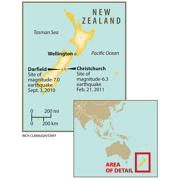
The magnitude 6.3 temblor that hit Christchurch Tuesday comes a scant five months after a magnitude 7.0 quake struck the region – the same magnitude as the earthquake that flattened much of Port-au-Prince, Haiti on Jan. 12, 2010. (Initial reports indicated September's earthquake had a magnitude of 7.4, but later estimates revised this downwards to 7.1 and then 7.0.)
Although the September quake released roughly 11 times the energy of Tuesday's quake and caused an estimated $4 billion (New Zealand; US$3 billion) in damage, no one was killed.
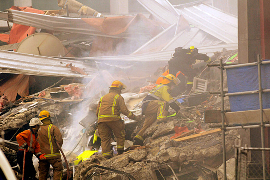
This time, at least 65 people have been killed, according to local reports.
The reasons, specialists say:
- The epicenter for Tuesday's quake, six miles from town and three miles deep, was far closer to Christchurch than the September quake, which occurred at the same depth, but with an epicenter some 30 miles west of the city.
- Tuesday's temblor struck during the middle of a work day, when buildings downtown were packed with people.
- While many of the buildings that collapsed Tuesday were older brick buildings in the city center, some buildings that otherwise might have withstood Tuesday's quake had yet to be repaired following September's event, and so also sustained heavy damage.
The geological setting for Tuesday's disaster is a stunningly landscaped laboratory for earth scientists but a challenge for emergency planners having to assess and plan for earthquake risks, researchers acknowledge.
The two islands that make up New Zealand sit squarely on top of the boundary between the Pacific and Australian plates, explains Chris Rowan, a geophysicist at the University of Chicago who has conducted research there.
East of New Zealand's northern island, a deep seafloor trench parallels the coast and extends some 2,000 miles to the north before it takes a hard left turn just south of Samoa.
Along this trench, the Pacific plate is diving under the Australian place at about 50 millimeters a year.
As the trench encounters the more-buoyant, weaker continental crust of New Zealand's southern island, the boundary shifts from deep-sea trench to a fault much like California's San Andreas fault, which bounds the Pacific and North American plates.
As a result of that change-over, Dr. Rowan says, faults appear in a wide swath on either side of the main boundary fault, in this case, New Zealand's Alpine fault.
The challenge for estimating seismic hazards in the Christchurch area, he continues, is that the rapid rise and constant erosion of the country's Alps to the west have spread sediment over the eastern side of the island, burying surface evidence of some of the faults making up the broader fault zone.
Last September's quake occurred on a previously-unknown fault, Rowan says. Referring to Tuesday's earthquake, he adds, "I suspect this was a fault that wasn't known about before," as well.
Geophysicists at the US Geological Survey's National Earthquake Information Center in Golden, Colo., are classifying the Christchurch quake as the largest aftershock to follow last September's quake. Before this, the region had experienced six aftershocks, all with a magnitude of 5 or less, according to the USGS.
The fault in yesterday's event was likely nearing the snapping point, Rowan adds. The change in stress triggered by the September quake probably hastened the fault's rupture.


