Hurricane Danielle forms in Atlantic, Earl on her heels
Loading...
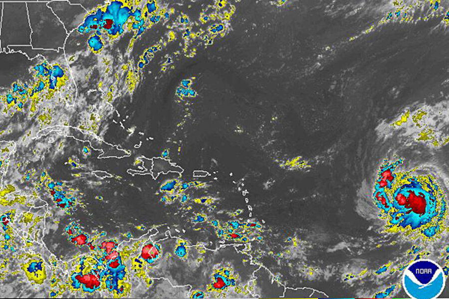
Say hello to hurricane Danielle, spinning up in the tropical Atlantic Ocean. And keep an eye peeled for a potential tropical storm Earl.
That's the word from the National Hurricane Center in Miami Tuesday morning as Danielle works its way toward the west-northwest at about 20 miles per hour from a spot roughly 1,000 miles east of the Leeward Islands.
Meanwhile, an angry red blotch on the center's storm-track map just south of the Cape Verde Islands signals a mass of thunderstorms that stands a 90 percent chance of becoming a tropical cyclone within the next 48 hours.
Forecasters could declare the mass a tropical depression later Tuesday, depending on how the storm cluster, known as a tropical wave, behaves. A tropical depression is one rung shy of becoming a named storm in the hierarchy of tropical cyclone activity.
Overnight, Danielle outgrew its tropical-storm status, and by 4 a.m. Eastern Daylight Time Tuesday it had become a Category 2 hurricane, with maximum sustained winds of some 98 m.p.h. A Category 2 storm generates sustained winds of between 96 and 110 m.p.h.
But by 11 a.m., forecasters demoted Danielle to a Category 1 storm. "The period of rapid intensification has ended with a thud," notes NHC hurricane specialist Robbie Berg, although forecasters expect the storm to slowly regain its Category 2 status over the next several days.
As Danielle moves up the map over the next five days, the only effect the US East Coast is likely to see – if the storm strengthens sufficiently – is an increase in storm-driven swells.
But "Bermuda needs to watch Danielle very carefully," says hurricane-center spokesman Dennis Feltgen. The five-day track forecast at the moment puts the center of the storm roughly 300 miles east of the British territory by 8 a.m. Sunday morning. But the island also touches the boundary of the track forecast's "uncertainty cone."
This means the island may have to contend with some rough conditions if the track shifts significantly westward during the week.
Past storms on a similar track at this stage of their development on average tend to head north into colder Atlantic waters, where they die out, avoiding the east coast of North America.
"But each storm is different," Mr. Feltgen cautions.
With the eastern seaboard statistically overdue for a landfalling hurricane, even a distant Danielle bears watching.


