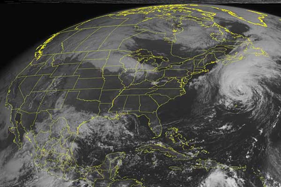
Hurricane Igor heads north, all the way to Greenland?
Loading...
For 12 days, hurricane Igor has been spinning through the Atlantic Ocean, first as a tropical storm, then as one of the 2010 season's handful of "major" hurricanes.
Now that it has pirouetted past the British Territory of Bermuda as a bottom tier hurricane, are the Inuit ready for Igor?
Between next Thursday morning and Friday morning, forecasters at the National Hurricane Center in Miami say they expect Igor to make landfall on the southern tip of Greenland, perhaps with tropical-storm-force winds, then to move into the interior as a "post-tropical" depression.
The label "post-tropical" refers to a shift in a storm's energy source. In Igor's case, its energy source is expected to shift by Tuesday morning.
As a tropical cyclone, Igor draws its energy from heat. That heat is released as water condenses from vapor to cloud droplets as the vapor rises higher into the atmosphere and cools, forming powerful thunderheads. As the storm moves north, it encounters cooler water and draws its energy from the difference in temperature between the storm itself and a cooler mass of air sweeping into the North Atlantic from middle and high latitudes. At that point, Igor earns the post-tropical tag.
These storms can still be dangerous, since they continue to pack gale-force winds. These winds typically blow at altitudes of from several hundred feet to a little over 1,000 feet. They can trigger significant wind damage if the storm encounters an environment that encourages mixing between air layers near the ground and the layers carrying the gale-force winds.
By the time Igor draws even with southern Newfoundland overnight Tuesday, it is expected to pack hurricane-force winds, although it will have become post-tropical. Igor's track is expected to come close enough to the Canadian province's southeastern tip, prompting the government to issue tropical-storm warnings for that area.
In Bermuda, residents are dealing with power failures, downed trees, and a handful of beached boats. Along the US east coast, Igor is expected to continue delivering high surf, with its accompanying rip currents through Tuesday morning.
So far, three fatalities have been attributed to Igor. All reportedly were due to people either trying to surf the high waves Igor was driving to shore, or standing too close to where high surf was breaking.
Meanwhile, tropical storm Julia is winding down some 1,770 miles west of the Azores. Currently packing sustained winds of about 45 miles an hour, Julia likely will be downgraded to a tropical depression by 8 a.m. Sept. 21.
As these two storms weaken, forecasters are watching another patch of stormy weather just west of the Cape Verde Islands. It stands an 80 percent chance of becoming a tropical cyclone within the next 48 hours, forecasters say.


