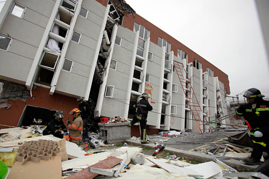
Chile earthquake lifted country's coast eight feet
Loading...
The Chilean earthquake that struck on Feb. 27 changed the country’s landscape by raising the ground by more than 8 feet near the coast and sinking land farther inward, a new study finds.
Chile is situated atop a hotspot for earthquake activity, so learning how this magnitude 8.8 quake moved the land will tell scientists more about what causes large earthquakes.
The massive earthquake struck south-central Chile and was the fifth largest temblor ever recorded by modern seismology. A nearby part of Chile gave birth to the largest earthquake ever recorded — a magnitude 9.5 earthquake that struck in May 1960 and killed 5,700 people. Since 1973, 13 quakes of magnitude 7.0 or greater have hit the coastal country, according to the U.S. Geological Survey (USGS).
IN PICTURES: Earthquake in Chile
Scientists have now confirmed for the first time that the 2010 quake ruptured a long fault along the coast of Chile, and found that it raised land to a higher elevation in the south and sunk the Earth's surface in the North, according to the study.
To the scientists patrolling the coast, the change is obvious.
"You can just see the sea shells and sea weed hanging in the air, about head high," said Michael Bevis, a geophysicist at Ohio State University who was not involved with the study but has conducted his own studies of the Chilean coast. "You see all this stuff that belongs underwater is now up in the rocks."
Researchers found a white fringe formed by a kind of dead algae that is common along the Chilean coast. These normally pink algae are bleached by sunshine, and gave researchers a direct way to measure the grounds' uplift. [See images of Chile's raised coast]
Using the algae as a marker, the research team, led by Marcelo Farias at the University of Chile, found that the largest uplift was roughly 8.2 feet (2.5 meters) at the Arauco Peninsula. The uplift also shifted the coastline in some places 1,640 feet (500 m) toward the ocean.
Measuring how much the land sank was somewhat trickier. The researchers gauged sinking by measuring how high the water had risen on vegetation and manmade constructions like bridges. A 3.3 foot (1 m) drop in land was measured in some parts, but the study acknowledges some uncertainly about the subsidence level because of the difficulty in knowing the water levels before the quake hit, and exactly how these water levels changed after the quake.
Despite this uncertainty, the research team arrived at the site of the quake so quickly — taking measurements within a month of the rupture — that they were able to measure the sudden jump of the land that happens after an earthquake, Bevis said. This is important because the land continues to shift over time. Separating out the various ground movements is one step toward painting a picture of how the land moves during massive quakes.
The new study is just one of many studies currently investigating the Chilean earthquake, which Bevis said "will probably turn out to be one of the most important earthquakes ever in terms of scientific impact."
"We've instrumented the crap out of the fifth biggest quake ever," Bevis told OurAmazingPlanet. "When we put this data together we're going to figure out what happened during and after the earthquake with an impressive level of detail."
Other movements around South America caused by the earthquake include:
- The Chilean city of Concepción moved at least 10 feet (3 meters) to the west.
- Buenos Aires, the capital of Argentina and across the continent from the quake's epicenter, moved about 1 inch (2.5 centimeters) to the west.
- Chile's capital, Santiago, moved about 11 inches (28 cm) to the west-southwest.
- The cities of Valparaiso and Mendoza, Argentina, northeast of Concepción, also moved significantly.
The study is detailed in the July 29 edition of the journal Science.


